Inspectial
- Inspectial
- Free checklists
- Damage assessment
Damage assessment form
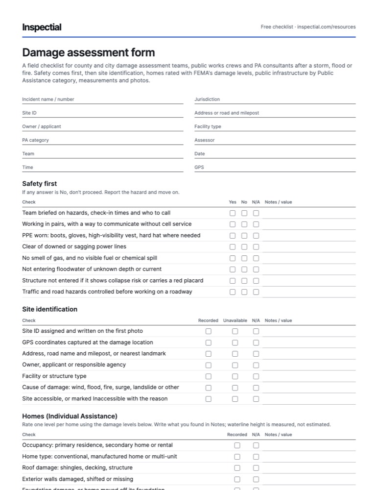
A field checklist for county and city damage assessment teams, public works crews and PA consultants after a storm, flood or fire. Safety comes first, then site identification, homes rated with FEMA's damage levels, public infrastructure by Public Assistance category, measurements and photos.
What is a damage assessment checklist?
A damage assessment checklist is a field form used after a disaster to record what was damaged, where, and how badly. Homes are rated Affected, Minor, Major or Destroyed under FEMA's Preliminary Damage Assessment Guide; public facilities are grouped by Public Assistance categories A to G, with photos, dimensions and evidence of pre-disaster condition.
When to inspect
After every incident that may exceed local resources: the local Initial Damage Assessment (IDA) within hours to days, then the joint state and FEMA Preliminary Damage Assessment (PDA) under 44 CFR 206.33 to support a declaration request. After a declaration, Public Assistance site inspections document each damaged site under the PA Program and Policy Guide.
The checklist
Every row is one observable check. Mark one answer per row and write what you saw or measured; the PDF adds a findings table and sign-off.
Header
- Incident name / number
- Jurisdiction
- Site ID
- Address or road and milepost
- Owner / applicant
- Facility type
- PA category
- Assessor
- Team
- Date
- Time
- GPS
Safety first
If any answer is No, don't proceed. Report the hazard and move on.
| Check | Yes | No | N/A | Notes / value |
|---|---|---|---|---|
| Team briefed on hazards, check-in times and who to call | ||||
| Working in pairs, with a way to communicate without cell service | ||||
| PPE worn: boots, gloves, high-visibility vest, hard hat where needed | ||||
| Clear of downed or sagging power lines | ||||
| No smell of gas, and no visible fuel or chemical spill | ||||
| Not entering floodwater of unknown depth or current | ||||
| Structure not entered if it shows collapse risk or carries a red placard | ||||
| Traffic and road hazards controlled before working on a roadway |
Site identification
| Check | Recorded | Unavailable | N/A | Notes / value |
|---|---|---|---|---|
| Site ID assigned and written on the first photo | ||||
| GPS coordinates captured at the damage location | ||||
| Address, road name and milepost, or nearest landmark | ||||
| Owner, applicant or responsible agency | ||||
| Facility or structure type | ||||
| Cause of damage: wind, flood, fire, surge, landslide or other | ||||
| Site accessible, or marked Inaccessible with the reason |
Homes (Individual Assistance)
Rate one level per home using the damage levels below. Write what you found in Notes; waterline height is measured, not estimated.
| Check | Recorded | N/A | Notes / value |
|---|---|---|---|
| Occupancy: primary residence, secondary home or rental | |||
| Home type: conventional, manufactured home or multi-unit | |||
| Roof damage: shingles, decking, structure | |||
| Exterior walls damaged, shifted or missing | |||
| Foundation damage, or home moved off its foundation | |||
| Waterline height inside the living space (measured) | |||
| Basement flooded, with utilities in the basement | |||
| Utilities out: power, water, sewer or gas | |||
| Home accessible by road | |||
| Insurance status asked and recorded: homeowners, flood | |||
| Damage level assigned: Affected, Minor, Major or Destroyed |
Public infrastructure by PA category
One row per finding. Note the category letter with each.
| Check | OK | Issue | N/A | Notes / value |
|---|---|---|---|---|
| A · Debris: type (vegetative, C&D, sediment) and estimated volume | ||||
| A · Hangers and leaners over public roads or property | ||||
| B · Emergency protective measures in place: barricades, pumping, sandbags | ||||
| C · Roadway washout or pavement failure | ||||
| C · Shoulder or embankment loss | ||||
| C · Culvert or drainage structure damaged, blocked or washed out | ||||
| C · Bridge approach washout or scour at piers and abutments | ||||
| C · Guardrail, signs and signals damaged | ||||
| D · Channel, levee, berm or detention basin damage | ||||
| E · Public building roof, walls or water intrusion | ||||
| E · Equipment, contents or vehicles damaged | ||||
| F · Water or sewer line break, lift station or plant damage | ||||
| F · Utility poles, lines or lighting down | ||||
| G · Parks, trails, playgrounds, docks or boat ramps damaged |
Measurements and pre-disaster evidence
Damage Description and Dimensions (DDD): what is damaged, how much, and what it was like before.
| Check | Recorded | Unavailable | N/A | Notes / value |
|---|---|---|---|---|
| Damaged dimensions: length, width and depth | ||||
| Material and construction type of the damaged element | ||||
| Quantity (square feet, linear feet, cubic yards, count) | ||||
| Pre-disaster photos or inspection records available | ||||
| Maintenance records for the facility available | ||||
| Prior unrepaired damage noted separately | ||||
| Insurance on the facility noted |
Photos and close-out
| Check | Yes | No | Notes / value |
|---|---|---|---|
| Overview photo showing the whole site and its surroundings | |||
| Close-ups of each damaged element with a scale or tape in frame | |||
| Photo of the site ID, address or road sign for location | |||
| Photos from the same spots as pre-disaster photos, if they exist | |||
| Immediate threats reported to the EOC | |||
| Follow-up needed recorded: engineer, utility, debris crew | |||
| Record synced or handed in before leaving the area |
Damage levels for homes (FEMA IA)
- Affected
- Mostly cosmetic damage. The home can still be lived in.
- Minor
- Repairable non-structural damage that can make the home livable again in a short time.
- Major
- Structural damage or other significant damage that needs extensive repairs.
- Destroyed
- A total loss, or damaged so badly that repair isn't economically feasible.
- Inaccessible
- The assessor can't reach the home to see it. Revisit when access returns.
Photos to take
- Overview of the site from a safe point, showing the extent of damage
- Site ID, address, house number or road sign for location
- Each damaged element, wide and close-up, with a tape or scale in frame
- Waterline marks inside and outside homes, with a tape held to the line
- Debris piles with a person-sized reference for volume (no people in shot)
- Washouts and scour with depth measured on a rod or tape
- Undamaged sections next to damaged ones, to show the before condition
- Hazards that stopped the assessment
Field tips
- Safety beats speed. A team that walks past a downed line to get a photo is a second incident.
- Photograph damage, not people. Residents' faces and personal belongings don't belong in the record.
- Measure the waterline with a tape. The difference between Minor and Major often comes down to a few inches against the outlets.
- Keep one site ID per location from the first photo to the final record. Renumbering in the office breaks the photo trail.
- Record pre-disaster evidence on site: an old inspection tag, a dated sign, maintenance markings. Public Assistance restores facilities to their pre-disaster design (44 CFR 206.226), so before-condition evidence matters.
- Use the same categories and damage levels the state and FEMA use, so your IDA rolls straight into the joint PDA.
- Mark sites you couldn't reach as Inaccessible, not skipped, so they are revisited.
Standards and sources
Checked against these sources on . Your agency's own manual takes precedence.
Questions
What are FEMA's damage levels for homes?
FEMA's Preliminary Damage Assessment Guide uses four levels: Affected (mostly cosmetic), Minor (repairable, non-structural), Major (structural or other significant damage needing extensive repairs) and Destroyed (total loss). Homes the team can't reach are recorded as Inaccessible. For floods the level depends largely on the measured waterline in the living space.
What are the FEMA Public Assistance categories?
Seven categories of work: A debris removal, B emergency protective measures, C roads and bridges, D water control facilities, E public buildings and equipment, F public utilities and G parks, recreational and other facilities. A and B are emergency work; C to G are permanent work.
What is the difference between an IDA and a PDA?
The Initial Damage Assessment (IDA) is done by the local jurisdiction, usually within hours or days, to see what happened and whether outside help is needed. The Preliminary Damage Assessment (PDA) is a joint state and FEMA assessment that verifies the damage and supports the governor's request for a federal declaration.
What documentation does FEMA Public Assistance need for a damaged site?
For each site: its location, photos of the damage, a damage description with dimensions, the cause, and evidence of the facility's pre-disaster condition and maintenance. FEMA restores facilities to their pre-disaster design, so dated photos and inspection records from before the event help. FEMA decides eligibility; the applicant's job is complete, clear documentation.
Who performs damage assessments?
Locally, emergency managers, building officials, public works staff and trained volunteers run the IDA. The joint PDA adds state and FEMA staff. After a declaration, PA applicants and their consultants document each site with FEMA site inspectors.
Do this inspection on your phone: AI drafts it, you approve
Inspectial turns the photos, voice notes and GPS from this checklist into a structured, map-ready inspection record. Every finding links to its photo, and nothing is official until you approve it.
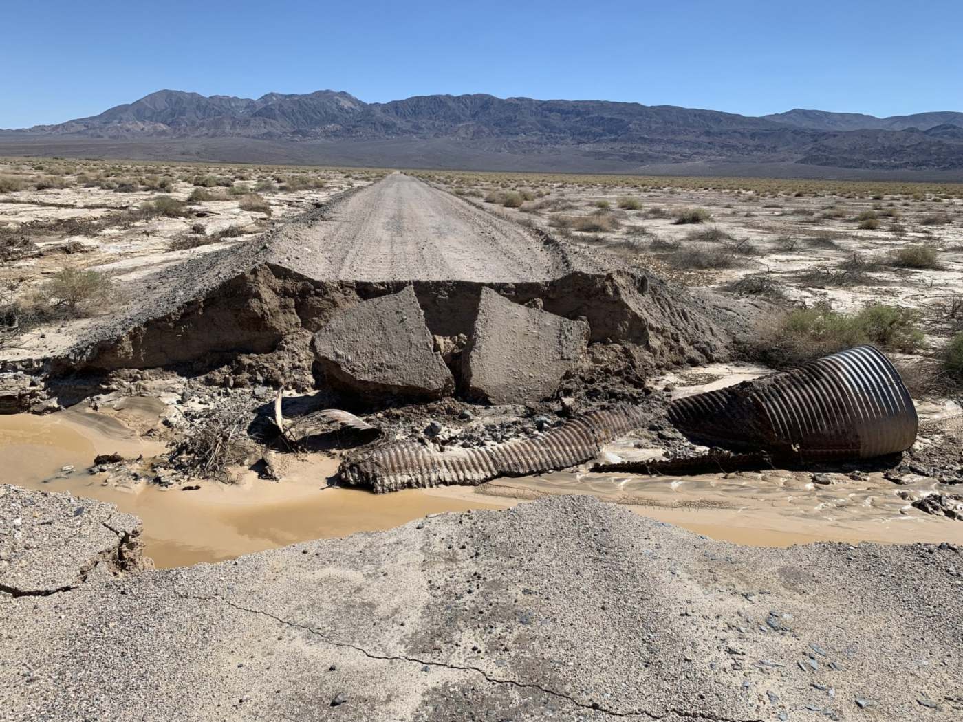
- Road · washoutfull roadway width, Cat. CHuman verified
- Road · pavementslabs displaced into gapHuman verified
- Culvert · positionwashed out of the fillAI suggested